Fascinating Locations You Won’t Believe are in the US

Shannon Quinn - September 7, 2022
Share

Looking for somewhere new to explore? While most people think you need to go outside of the US to see some of the most wondrous places the world has to offer, the American landscape is actually one of the most unique the world has to offer. Here are some of the greatest places you can travel, and you wouldn’t believe they’re in the USA.

When you’re done reading this, check out The Most Unusual Buildings in Each State You Should Visit on Your Next Road Trip.
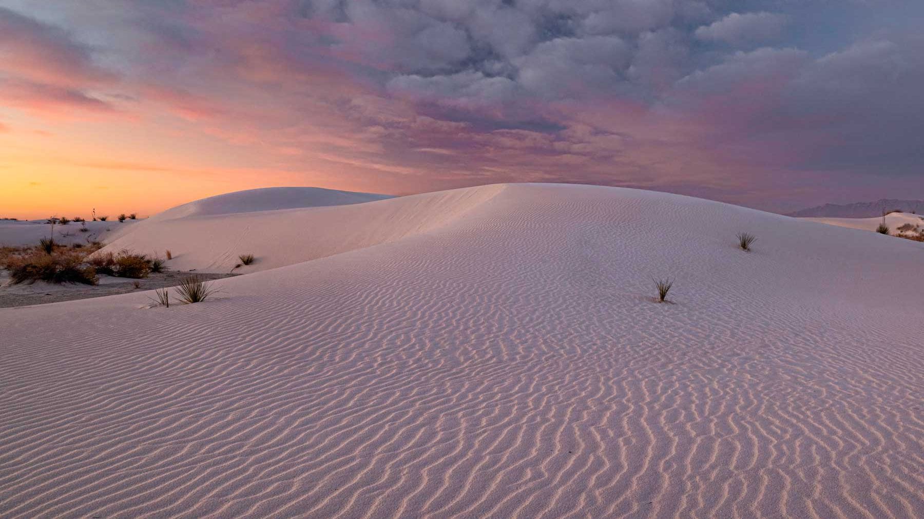
The White Sands National Park. Credit: Travel and Leisure

White Sands National Park, New Mexico

White Sands National Park is an American national park located in the state of New Mexico. The park covers 145,762 acres in the Tularosa Basin, including the field of white dunes composed of gypsum crystals. This gypsum dune field is the largest of its kind on Earth, with a depth of about 30 feet, and dunes as tall as 60 feet.
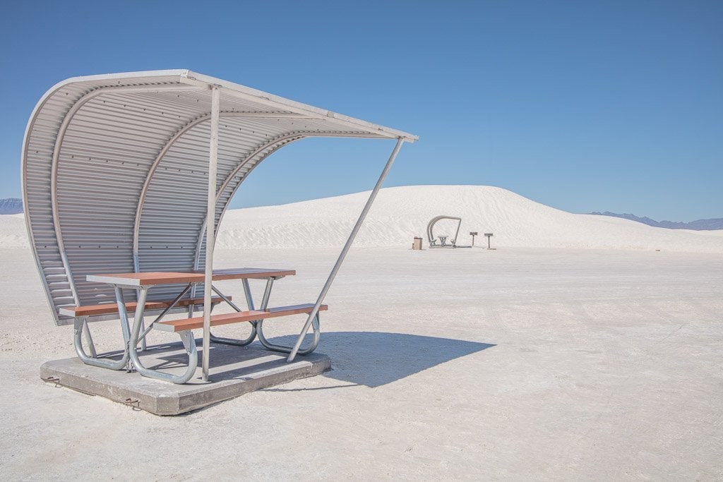
The park comes with picnic tables that are protected from the harsh sun. Credit: Adventures of Nicole

Approximately 12,000 years ago, the Tularosa Basin featured large lakes, streams, grasslands, and Ice Age mammals. As the climate warmed, rain and snowmelt dissolved gypsum from the surrounding mountains and carried it into the basin. Further warming and drying caused the lakes to evaporate and form selenite crystals. Strong winds then broke up crystals and transported them eastward. A similar process continues to produce gypsum sand today. Thousands of species of animals inhabit the park, a large portion of which are invertebrates. Several animal species feature a white or off-white coloration. (via National Park Service)

The flower fields at Carlsbad Ranch. Credit: Visit Carlsbad

The Flower Fields at Carlsbad Ranch, California

When you visit the Flower Fields at Carlsbad Ranch, it’s hard to believe that it’s actually located in the United States. The fields today are a direct result of nearly 85 years of floral cultivation that began with Luther Gage in the 1920’s. The ranunculus is native to Asia Minor and a member of the buttercup family. Originally the flowers were single petal contact and ranged in shades of red and yellow. The beautiful colors and fullness of the flowers you see now are due to the careful selection done by Edwin Frazee over many years.

Carlsbad Ranch has several different flowers growing on the farm. Credit: Trip Savvy

From its humble beginnings in Luther Gage’s flower beds to one of San Diego County’s most enduring and recognizable landmarks, The Flower Fields continue to showcase nature’s artistry and to symbolize the diligence of a couple of the region’s most important and colorful pioneers. It is now a place where tourists are welcome to visit. (via The Flower Fields)

Leavenworth, Washington town square. Credit: Leavenworth

Leavenworth, Washington

Leavenworth is a city in Chelan County, Washington, United States. The entire town center is modeled on a German Bavarian village as part of a civic initiative that began in the 1960s. The area is a major, four-season tourist destination with festivals nearly every month and a multitude of events year round.

The front of several shops in Leavenworth. Credit: World Wild Hearts

Leavenworth is a Bavarian-styled village in the Cascade Mountains, in central Washington State. Alpine-style buildings with restaurants serving German beer and food line Front Street. The Nutcracker Museum displays thousands of nutcrackers, some dating back centuries. On the Wenatchee River, Waterfront Park is a habitat for ospreys and eagles. The village is a gateway to nearby ski areas and wineries. (via Leveanworth)

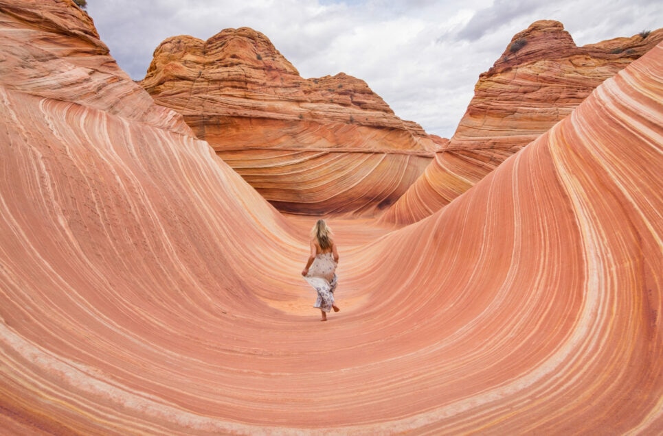
The Wave in Arizona. Credit: Wikimedia Commons

The Wave, Arizona

The Wave is a sandstone rock formation located in Arizona, near the border of Utah. The formation is situated on the slopes of the Coyote Buttes in the Paria Canyon-Vermilion Cliffs Wilderness of the Colorado Plateau. The formation is well-known among hikers and photographers for its colorful, undulating forms and the difficult hike required to reach it.

There is a lottery system to see who is allowed to hike there. Credit: Wandering Wheatleys

Due to the fragile nature of the formation and the large number of people wishing to visit it, a daily lottery system is used to dispense permits for up to 16 people and/or 4 groups (whichever comes first) two days before. Online permits for each date are available four months in advance of a planned trip. A map and information about the hike are supplied to those who have obtained permits. (via The Wave)

Sequoia and Kings Canyon National Park. Credit: National Park Systems

Sequoia and Kings Canyon National Parks, California

Sequoia National Park is located in Sierra, Nevada. The park was established on September 25, 1890, to protect 404,064 acres of forested mountainous terrain. Encompassing a vertical relief of nearly 13,000 feet, the park contains the highest point in the United States, Mount Whitney, at 14,505 feet above sea level. The park is south of, and contiguous with, Kings Canyon National Park; both parks are administered by the National Park Service together as the Sequoia and Kings Canyon National Parks.

The beautiful scene of the mountains and trees. Credit: Wikimedia Commons

The park is notable for its giant sequoia trees, including the General Sherman tree, the largest tree on Earth by volume. The General Sherman tree grows in the Giant Forest, which contains five of the ten largest trees in the world. The park’s giant sequoia forests are part of 202,430 acres of old-growth forests shared by Sequoia and Kings Canyon National Parks. The parks preserve a landscape that was first cultivated by the Monachee tribe, the southern Sierra Nevada before Euro-American settlement. (via National Park Services)

The Biltmore Estate. Credit: Wikimedia Commons

The Biltmore Estate, North Carolina

Biltmore Estate is a historic house museum and tourist attraction in Asheville, North Carolina. The main residence is a Châteauesque-style mansion built for George Washington Vanderbilt II between 1889 and 1895 and is the largest privately owned house in the United States. Still owned by George Vanderbilt’s descendants, it remains one of the most prominent examples of Gilded Age mansions.

The outside of the Biltmore Estate. Credit: Wikimedia Commons

Vanderbilt named his estate Biltmore, combining De Bilt (his ancestors’ place of origin in the Netherlands) with more (mōr, Anglo-Saxon for “moor”, an open, rolling land). Vanderbilt bought nearly 700 parcels of land, including over 50 farms and at least five cemeteries; a portion of the estate was once the community of Shiloh. A spokesperson for the estate said in 2017 that archives show much of the land “was in very poor condition, and many of the farmers and other landowners were glad to sell.” (via Biltmore)

The Mendenhall Ice Caves. Credit: Atlas Obscura

Mendenhall Ice Caves, Alaska

In the Mendenhall Ice Caves,water runs over rocks and under frozen bright-blue ceilings inside a partially hollow glacier. The Mendenhall Glacier is a 12-mile-long glacier in the Mendenhall Valley, only 12 miles from downtown Juneau in southeast Alaska. The glacier originally had two names: Sitaantaagu (“Glacier Behind the Town”) and Aak’wtaaksit (“Glacier Behind the Little Lake”). Inside the glacier are the stunning blue ice caves, accessible only to those willing to kayak to the edge of the ice and then climb over the glacier.

The outside of the Mendenhall Glacier. Credit: Atlas Obscura

Sadly, this Juneau glacier is retreating increasingly fast as climate change warms the ocean. The Mendenhall Glacier has receded almost two miles since 1958, while previously it had receded only 0.5 miles since 1500. The ice caves are in part a function of this glacial melting. Images of the caves circulate the internet with such captions as “otherworldly” and “surreal,” but “shrinking” and “fleeting” could be used as well, as this glacier creates incredible ever-changing landscapes while we watch it melt away. (via Atlas Obscura)

The Grand Prismatic Spring in Yellowstone National Park. Credit: Wikimedia Commons

Grand Prismatic Spring

The Grand Prismatic Spring in Yellowstone National Park is the largest hot spring in the United States, and the third largest in the world, after Frying Pan Lake in New Zealand and Boiling Lake in Dominica. It is located in the Midway Geyser Basin. But let’s get this warning out of the way: under no circumstances should you leave the boardwalk and attempt to swim in its alluring depths. Thermal features at Yellowstone National Park are extremely hot and can be acidic.

A closeup of the Grand Prismatic Spring. Credit: Wikimedia Commons

Grand Prismatic Spring was noted by geologists working in the Hayden Geological Survey of 1871, and named by them for its striking coloration. Its colors match most of those seen in the rainbow dispersion of white light by an optical prism: red, orange, yellow, green, and blue. (via Yellowstone Park)

The Met Cloisters. Credit: Wikimedia Commons

The Met Cloisters, New York

The Cloisters, also known as the Met Cloisters, is a museum in New York City, specializing in European medieval art and architecture, with a focus on the Romanesque and Gothic periods. Governed by the Metropolitan Museum of Art, it contains a large collection of medieval artworks shown in the architectural settings of French monasteries and abbeys. Its buildings are centered around four cloisters—the Cuxa, Saint-Guilhem, Bonnefont and Trie—that were acquired by American sculptor and art dealer George Grey Barnard in France before 1913, and moved to New York.

The garden of the Met Cloisters. Credit: Wikimedia Commons

It contains medieval gardens and a series of chapels and themed galleries, including the Romanesque, Fuentidueña, Unicorn, Spanish and Gothic rooms. The design, layout, and ambiance of the building are intended to evoke a sense of medieval European monastic life. It holds about 5,000 works of art and architecture, all European and mostly dating from the Byzantine to the early Renaissance periods, mainly during the 12th through 15th centuries. (via Met Museum)

The sunset on the Bonneville Salt Flats. Credit: Wikimedia Commons

Bonneville Salt Flats, Utah

The Bonneville Salt Flats are a densely packed salt pan in Tooele County in northwestern Utah. A remnant of the Pleistocene Lake Bonneville, it is the largest of many salt flats west of the Great Salt Lake. It is public land managed by the Bureau of Land Management and is known for land speed records at the Bonneville Speedway. Access to the Flats is open to the public.

The salt flats welcome many visitors. Credit: Wikimedia Commons

The Flats are about 12 miles (19 km) long and 5 miles (8 km) wide, with a crust almost 5 ft (1.5m) thick at the center and less than one inch (2.5 cm) towards the edges. It is estimated to hold 147 million tons of salt, approximately 90% of which is common table salt. (via Utah)

Death Valley National Park. Credit: Wikimedia Commons

Death Valley National Park, California/Nevada

Death Valley National Park is an American national park that straddles the California-Nevada border, east of the Sierra Nevada. The park boundaries include Death Valley, the northern section of Panamint Valley, the southern section of Eureka Valley and most of Saline Valley. The park occupies an interface zone between the arid Great Basin and Mojave deserts, protecting the northwest corner of the Mojave Desert and its diverse environment of salt-flats, sand dunes, badlands, valleys, canyons and mountains. Death Valley is the largest national park in the contiguous United States, as well as the hottest, driest and lowest of all the national parks in the United States

Death Valley National Park. Credit: Wikimedia Commons

It contains Badwater Basin, the second-lowest point in the Western Hemisphere and lowest in North America at 282 feet (86 m) below sea level. More than 93% of the park is a designated wilderness area. The park is home to many species of plants and animals that have adapted to this harsh desert environment. This includes creosote bush, Joshua tree, bighorn sheep, coyote, and the endangered Death Valley pupfish, a survivor from much wetter times. (via National Park Service)

Old Town in St. Augustine, Florida. Credit: Trip Savvy

St. Augustine, Florida

St. Augustine, Florida looks as if it was picked up from the Mediterranean and shipped overseas. Many of the town’s buildings feature Spanish-style architecture, a nod to its Spanish colonial period in the 16th century. Founded in 1565 by Spanish explorers, it is the oldest continuously inhabited European-established settlement in what is now the contiguous United States.

The beautiful buildings of St Augustine Florida. Credit: Hotels

Spain ceded Florida to the United States in 1819, and St. Augustine was designated the capital of the Florida Territory upon ratification of the Adams-Onís Treaty in 1821. The Florida National Guard made the city its headquarters that same year. The territorial government moved and made Tallahassee the capital of Florida in 1824. St. Augustine is part of Florida’s First Coast region and the Jacksonville metropolitan area. Since the late 19th century, St. Augustine’s distinctive historical character has made the city a tourist attraction. (via Wikipedia)

The Hoh Rain Forest. Credit: The Seven Wonders of Washington State

Hoh Rain Forest, Washington

Hoh Rainforest is one of the largest temperate rainforests in the U.S., located on the Olympic Peninsula in western Washington state. The Hoh River valley was formed thousands of years ago by glaciers. Within Olympic National Park, the forest is protected from commercial exploitation. The word “Hoh” undoubtedly comes from Native American languages; possibly the Quileute word “Ohalet” which means “fast moving water” or “snow water.” Since the river itself forms from glacial runoff.

The Hoh River. Credit: Wikimedia Commons

Throughout the winter season, rain falls frequently in the Hoh Rain Forest, contributing to the yearly average of 140 inches of precipitation each year. The result is a lush, green canopy of both coniferous and deciduous species. Mosses and ferns that blanket the surfaces add another dimension to the enchantment of the rainforest. The Hoh is one of the finest remaining examples of temperate rainforest in the United States and is one of the park’s most popular destinations. (via National Park Service)

Portland Japanese Garden. Credit: Wikimedia Commons

Portland Japanese Garden, Oregon

The Portland Japanese Garden is a traditional Japanese garden occupying 12 acres, located within Washington Park in the West Hills of Portland, Oregon. It is operated as a private non-profit organization, which leased the site from the city in the early 1960s. When His Excellency Nobuo Matsunaga, the former Ambassador of Japan to the United States, visited Portland Japanese Garden, he proclaimed it to be “the most beautiful and authentic Japanese garden in the world outside of Japan.”

The rock garden at the Portland Japanese Gardens. Credit: Wikimedia Commons

The Garden sits nestled in the hills of Portland, Oregon’s iconic Washington Park, overlooking the city and providing a tranquil, urban oasis for locals and travelers alike. Designed in 1963, it encompasses 12 acres with eight separate garden styles, and includes an authentic Japanese Tea House, meandering streams, intimate walkways, and a spectacular view of Mt. Hood. (via Japanese Garden)

Mono Lake in California. Credit: Wikimedia Commons

Mono Lake, California

Mono Lake is a saline soda lake in Mono County, California, formed at least 760,000 years ago as a terminal lake in an endorheic basin. The lack of an outlet causes high levels of salts to accumulate in the lake which make its water alkaline. The desert lake has an unusually productive ecosystem based on brine shrimp, which thrive in its waters, and provides critical habitat for two million annual migratory birds that feed on the shrimp and alkali flies.

A beautiful sunset over Mono Lake. Credit: Trip Advisor

Historically, the native Kutzadika’a people ate the alkali flies’ pupae, which live in the shallow waters around the edge of the lake. When the city of Los Angeles diverted water from the freshwater streams flowing into the lake, it lowered the lake level, which imperiled the migratory birds. The Mono Lake Committee formed in response and won a legal battle that forced Los Angeles to partially replenish the lake level (via Mono Lake)

Boats exploring the Molokini crater. Credit: Wikimedia Commons

Molokini Crater, Hawaii

Molokini is a crescent-shaped, partially submerged volcanic crater which forms a small, uninhabited islet located in ʻAlalākeiki Channel between the islands of Maui and Kahoʻolawe, within Maui County in Hawaiʻi. It is the remains of one of the seven Pleistocene epoch volcanoes that formed the prehistoric Maui Nui island, during the Quaternary Period of the Cenozoic Era.

North Molokini. Credit: Wikimedia Commons

The islet has an area of 23 acres, a diameter of about 0.4 miles, is 161 feet at its highest point, and is located about 2.5 miles (4.0 km) west of Makena State Park and south of Maʻalaea Bay. The islet is a Hawaiʻi State Seabird Sanctuary. (via Molokini Crater)

Pella, Iowa. Credit: Wikimedia Commons

Pella, Iowa

The town of Pella, Iowa is very proud of its Dutch heritage. Downtown is home to the tallest working grain windmill in the country. There’s also the Molengracht Canal, which is reminiscent of Amsterdam’s own canal system — it’s even lined with Amsterdam-style architecture!

The main street of Pella, Iowa. Credit: Wikimedia Commons

Pella is a city in Marion County, Iowa, United States, with a population of 10,464 at the time of the 2020 U.S. Census. Founded by immigrants from the Netherlands, it is forty miles southeast of Des Moines. Pella is the home of Central College, as well as several manufacturing companies, including Pella Corporation and Vermeer Manufacturing Company. (via City of Pella)

Lavender fields in Sequim, Washington. Credit: Wikimedia Commons

Sequim, Washington

No, these fragrant lavender fields are not in the south of France. They’re found in Sequim, Washington, which hosts an annual lavender festival each summer. Sequim is a city in Clallam County, Washington, United States. It is located along the Dungeness River near the base of the Olympic Mountains.

The John Wayne Marina in Sequim, WA Credit: Wikimedia Commons

The city and the surrounding area are particularly known for the commercial cultivation of lavender, supported by the unique climate. It makes Sequim the “Lavender Capital of North America”, rivaled only in France. The area is also known for its Dungeness crab. Sequim is pronounced as one syllable, with the e elided: “skwim”. The name developed from the Klallam language. (via Sequim WA)

Castello di Amorosa. Credit: Wikimedia Commons

Castello di Amorosa, California

Castello di Amorosa is a winery located near Calistoga, California. The winery opened to the public in April 2007, as the project of a fourth-generation vintner, Dario Sattui, who also owns and operates the V. Sattui Winery named after his great-grandfather, Vittorio Sattui, who originally established a winery in San Francisco in 1885 after emigrating from Italy to California.

The wine cellar in Castello di Amorosa. Credit: Wikimedia Commons

The winery property was once part of an estate owned by Edward Turner Bale. In 1993, Sattui purchased 171 acres (69 ha) for $3.1 million, then spent another $40 million to construct the castle, outbuildings, and the winery inside the castle; construction work began in 1995. During the Glass Fire that began on September 27, 2020, the farmhouse suffered major damage, the entire 2020 vintage of the wine Fantasia was lost, but the castle was left unharmed. (via Castello di Amorosa)

Crater lake in the winter time. Credit: Wikimedia Commons

Crater Lake, Oregon

Crater Lake is a volcanic crater lake in south-central Oregon in the western United States. It is the main feature of Crater Lake National Park and is famous for its deep blue color and water clarity. The lake partly fills a 2,148-foot-deep caldera that was formed around 7,700 years ago by the collapse of the volcano Mount Mazama. There are no rivers flowing into or out of the lake; the evaporation is compensated for by rain and snowfall at a rate such that the total amount of water is replaced every 250 years. With a depth of 1,949 feet, the lake is the deepest in the United States. In the world, it ranks ninth for maximum depth, and third for mean (average) depth.

Crater Lake. Credit: Hudson Valley Happenings

Crater Lake features two small islands. Wizard Island, located near the western shore of the lake, is a cinder cone approximately 316 acres in size. Phantom Ship, a natural rock pillar, is located near the southern shore. Since 2002, one of Oregon’s regular-issue license plate designs has featured Crater Lake and a one-time plate surcharge is used to support the operation of Crater Lake National Park. The commemorative Oregon State Quarter, which was released by the United States Mint in 2005, features an image of Crater Lake on its reverse. The lake and surrounding park areas offer many recreational activities including hiking, biking, snowshoeing, fishing, and cross-country skiing are available, and during the summer, campgrounds and lodges at Crater Lake are open to visitors. (via National Park Service)

A sun beam coming through Antelope Canyon. Credit: Wikimedia Commons

Antelope Canyon, Arizona

Navajo Upper Antelope Canyon is a slot canyon in the American Southwest, on Navajo land east of Lechee, Arizona. It includes five separate, scenic slot canyon sections on the Navajo Reservation, referred to as Upper Antelope Canyon (or The Crack), RattleSnake Canyon, Owl Canyon, Mountain Sheep Canyon and Lower Antelope Canyon (or The Corkscrew). It is the primary attraction of Lake Powell Navajo Tribal Park, along with a hiking trail to Rainbow Bridge National Monument.

The red rocks of Antelope Canyon. Credit: Wikimedia Commons

The Navajo name for Upper Antelope Canyon is Tsé bighánílíní, which means ‘the place where water runs through the (Slot Canyon) rocks’. Lower Antelope Canyon is Hazdistazí (called “Hasdestwazi” by the Navajo Parks and Recreation Department), or ‘spiral rock arches’. Both are in the LeChee Chapter of the Navajo Nation.They are accessible by Navajo guided tour only. (via Visit Arizona)

Vizcaya Museum and Gardens. Credit: Wikimedia Commons

Vizcaya Museum and Gardens, Florida

The Vizcaya Museum and Gardens, previously known as Villa Vizcaya, is the former villa and estate of businessman James Deering, of the Deering McCormick-International Harvester fortune, on Biscayne Bay in the present-day Coconut Grove neighborhood of Miami, Florida. The early 20th-century Vizcaya estate also includes extensive Italian Renaissance gardens, native woodland landscape, and a historic village outbuildings compound.

The Vizcaya Mansion. Credit: Wikimedia Commons

The landscape and architecture were influenced by Veneto and Tuscan Italian Renaissance models and designed in the Mediterranean Revival architecture style, with Baroque elements. F. Burrall Hoffman was the architect, Paul Chalfin was the design director, and Diego Suarez was the landscape architect. Miami-Dade County now owns the Vizcaya property, as the Vizcaya Museum and Gardens, which is open to the public. The location is served by the Vizcaya Station of the Miami Metrorail. (via Vizcaya)

The Hamilton Pool Preserve. Credit: Wikimedia Commons

Hamilton Pool Preserve, Texas

Hamilton Pool Preserve is a recreational destination located in the Texas Hill Country west of Austin. Reservations are required to visit, and it is open for hiking and sight-seeing. Hamilton Pool is a natural pool that was created when the dome of an underground river collapsed due to massive erosion thousands of years ago. The pool is located about 23 miles (37 km) west of Austin, Texas off Highway 71. Since the 1960s, Hamilton Pool has been a popular summer swimming spot for Austin visitors and residents. Hamilton Pool Preserve consists of 232 acres of protected natural habitat featuring a jade green pool into which a 50-foot waterfall flows with water temperatures reaching 50 degrees Fahrenheit.

The waterfall going over the Hamilton Pool Reserve. Credit: Wikimedia Commons

The pool is surrounded by large slabs of limestone that rest by the water’s edge; large stalactites grow from the ceiling high above. The ceiling and surrounding cliffs of the grotto are home to moss, maidenhair fern and cliff swallows. The Ashe juniper (cedar) uplands of the preserve are home to the endangered golden-cheeked warbler. The natural pool and creek are not chemically treated, so water quality is monitored regularly and swimming is occasionally restricted. Hamilton Pool is part of the Balcones Canyonlands Preserve and is a protected environment. (via Travis County Parks)

Beautiful buildings in Vail, Colorado. Credit: Wikimedia Commons

Vail, Colorado

The ski destination of Vail, Colorado feels more akin to a Bavarian town than an American one. Its downtown area, called Vail Village, was inspired by Alpine mountain villages. Vail is a home rule municipality in Eagle County, Colorado, United States. The population of the town was 4,835 in 2020. The town, home to Vail Ski Resort, the largest ski mountain in Colorado, is known for its hotels, dining, and for the numerous events the city hosts annually, such as the Vail Film Festival, Vail Resorts Snow Days, and Bravo! Vail.

Vail is a popular ski resort town. Credit: Wikimedia Commons

Vail was incorporated in 1966, four years after the opening of Vail Ski Resort. The ski area was founded by Pete Seibert and local rancher Earl Eaton in 1962, at the base of Vail Pass. The pass was named after Charles Vail, the highway engineer who routed U.S. Highway 6 through the Eagle Valley in 1940, which eventually became Interstate 70. Seibert, a New England native, served in the U.S. Army’s 10th Mountain Division during World War II, which trained at Camp Hale, 14 miles south of Vail between Red Cliff and Leadville. He was wounded in Italy at the Battle of Riva Ridge but went on to become a professional skier after he recovered. (via Wikipedia)

The Palouse hills. Credit: Wikimedia Commons

The Palouse, Idaho/Washington/Oregon

The Palouse is a distinct geographic region of the northwestern United States, encompassing parts of north central Idaho, southeastern Washington, and by some definitions, parts of northeast Oregon. It is a major agricultural area, primarily producing wheat and legumes. Situated about 160 miles (260 km) north of the Oregon Trail, the region experienced rapid growth in the late 19th century.

The Palouse in the early summertime. Credit: Wikimedia Commons

Many people believe the name of the Palus tribe (spelled in early accounts variously Palus, Palloatpallah, Pelusha, et cetera) was converted by French-Canadian fur traders to the more familiar French word pelouse, meaning “land with short and thick grass” or “lawn.” Over time, the spelling changed to Palouse. The Palouse is home to two land-grant universities: the University of Idaho in Moscow and Washington State University in Pullman. Just eight miles (13 km) apart, both schools opened in the early 1890s. (via Seven Wonders of Washington State)

Boldt Castle. Credit: Wikimedia Commons

Boldt Castle, New York

Boldt Castle is a major landmark and tourist attraction in the Thousand Islands region of New York. Open to guests seasonally between mid-May and mid-October, it is located on Heart Island in the Saint Lawrence River. Originally a private mansion built by American millionaire George Boldt, it is now maintained by the Thousand Islands Bridge Authority as a tourist attraction. George Boldt, general manager of the Waldorf-Astoria Hotel in New York City and manager of the Bellevue-Stratford Hotel in Philadelphia, and his family enjoyed an earlier frame cottage on Hart Island (the island’s original name) for several summers, which they greatly expanded.

The power house. Credit: Wikimedia Commons

The construction of Boldt Castle ceased abruptly in early 1904 after the death of Boldt’s wife, Louise Kehrer Boldt. For 73 years, the castle and other stone structures were left exposed to the harsh winter weather and occasional vandals. The Thousand Islands Bridge Authority acquired Heart Island and the nearby yacht house in 1977 for one dollar, under the agreement that all revenues obtained from the castle operation would be applied towards restoration, so that the island would be preserved for the enjoyment of future generations. (via Boldt Castle)

Great Sand Dunes National Park. Credit: Wikimedia Commons

Great Sand Dunes National Park, Colorado

Great Sand Dunes National Park and Preserve is an American national park that conserves an area of large sand dunes up to 750 feet on the eastern edge of the San Luis Valley, and an adjacent national preserve in the Sangre de Cristo Range, in south-central Colorado. The park was originally designated Great Sand Dunes National Monument on March 17, 1932, by President Herbert Hoover. The original boundaries protected an area of 35,528 acres.

A giant sand dune. Credit: Wikimedia Commons

The park contains the tallest sand dunes in North America. The dunes cover an area of about 30 sq mi and are estimated to contain over 1.2 cubic miles of sand. Sediments from the surrounding mountains filled the valley over geologic time periods. After lakes within the valley receded, exposed sand was blown by the predominant southwest winds toward the Sangre de Cristos. Eventually it formed the dune field over an estimated tens of thousands of years. The four primary components of the Great Sand Dunes system are the mountain watershed, the dunefield, the sand sheet, and the sabkha. Ecosystems within the mountain watershed include alpine tundra, subalpine forests, montane woodlands, and riparian zones. (via National Park Service)

Middle Oneonta Falls. Credit: Wikimedia Commons

Oneonta Gorge, Oregon

Oneonta Gorge is a scenic gorge located in the Columbia River Gorge area in Oregon. The U.S. Forest Service has designated it as a botanical area because of the unique aquatic and woodland plants that grow there. Exposed walls of 25-million-year-old basalt are home to a wide variety of ferns, mosses, hepatics, and lichens, many of which grow only in the Columbia River Gorge. There are four major waterfalls on Oneonta Creek as it runs through the gorge.

Oneonta Gorge. Credit: google Images

The trail has issues due to natural as well as human impacts. In the late 1990s, the stream was partially occluded when three large boulders tumbled into the stream. Subsequently, a log jam has formed in the midst of the slot canyon.] This has created a hazard for hikers, which led to a fatality in 2011. As of November 2020, trails providing access to the waterfalls remain closed due to damage from the 2017 Eagle Creek Fire. The Oneonta Gorge was first photographed by Carleton Eugene Watkins, a native of Oneonta, New York, who had traveled west in 1851 during the time of the California Gold Rush. Watkins named the Oneonta Falls after his hometown. (via USDA)

Tivoli Square in Solvang, California. Credit: Wikimedia Commons

Solvang, California

Solvang is Danish for “sunny fields”. It is a city in Santa Barbara County, California. It is located in the Santa Ynez Valley. The population was 6,126 at the 2020 census, up from 5,245 at the 2010 census. Solvang was founded in 1911 and incorporated as a city on May 1, 1985. Solvang is often dubbed “The Danish Capital of America”. Solvang’s origins date back to 1804, when Mission Santa Inés was founded by the Spanish under Esteban Tápis. A small community grew up around the mission called Santa Inés during the Mexican period, but it was largely abandoned after the American Conquest of California.

Solvang, California. Credit: Wikimedia Commons

In 1911, a new settlement was founded around the mission by a group of Danish-Americans who purchased 9,000 acres of the surrounding Rancho San Carlos de Jonata. The community took on its distinctive Danish-themed architecture beginning in 1947 and has since become a prominent tourist destination.Though only about 10% of residents in the 21st century are Danish, the town attracts many tourists from the Nordic countries, and has been the subject of several Danish royal visits, most recently by Prince Henrik in 2011. (via Solvang USA)

Badlands National Park. Credit: Wikimedia Commons

Badlands National Park, South Dakota

Badlands National Park is an American national park located in southwestern South Dakota. The park protects 242,756 acres of sharply eroded buttes and pinnacles, along with the largest undisturbed mixed grass prairie in the United States. The National Park Service co-managed with the Oglala Lakota tribe. The Badlands Wilderness protects 64,144 acres. Badlands was re-designated a national park on November 10, 1978. The movies Dances with Wolves (1990) and Thunderheart (1992) were partially filmed in Badlands National Park.

The Black Hills. Credit: Wikimedia Commons

This national park was originally a reservation of the Oglala Sioux Indians and spans the southern unit of the park. The area around Stronghold Table was originally Sioux territory, and is revered as a ceremonial sacred site rather than a place to live. In 1868, at the Second Treaty of Fort Laramie, the United States assured the Sioux that the Badlands shall forever be the property of the Sioux. In 1889, however, the treaty was broken and the Badlands were confiscated by the United States and unilaterally incorporated into a national park. (via National Park Service)

The Everglades at sunset. Credit: Wikimedia Commons

Everglades National Park, Florida

Everglades National Park is an American national park that protects the southern twenty percent of the original Everglades in Florida. The park is the largest tropical wilderness in the United States and the largest wilderness of any kind east of the Mississippi River. An average of one million people visit the park each year. Everglades is the third-largest national park in the contiguous United States after Death Valley and Yellowstone. UNESCO declared the Everglades & Dry Tortugas Biosphere Reserve in 1976 and listed the park as a World Heritage Site in 1979, and the Ramsar Convention included the park on its list of Wetlands of International Importance in 1987.

Sunrise on the pine rocklands on Long Pine Key Nature Trail. Credit: Wikimedia Commons

Most national parks preserve unique geographic features; Everglades National Park was the first created to protect a fragile ecosystem. The Everglades are a network of wetlands and forests fed by a river flowing 0.25 miles (0.40 km) per day out of Lake Okeechobee, southwest into Florida Bay. Thirty-six threatened or protected species inhabit the park, including the Florida panther, the American crocodile, and the West Indian manatee, along with 350 species of birds, 300 species of fresh and saltwater fish, 40 species of mammals, and 50 species of reptiles. The majority of South Florida’s fresh water, which is stored in the Biscayne Aquifer, is recharged in the park. (via National Park Service)

The Hubbard Glacier. Credit: Wikimedia Commons

Hubbard Glacier, Alaska/Canada

Hubbard Glacier is a glacier located in Wrangell-St. Elias National Park and Preserve in eastern Alaska and Kluane National Park and Reserve in Yukon, Canada, and named after Gardiner Hubbard. Before it reaches the sea, Hubbard is joined by the Valerie Glacier to the west. Through forward surges of its own ice, has contributed to the advance of the ice flow that experts believe will eventually dam the Russell Fjord from Disenchantment Bay waters.

A cruise ship sailing past the Hubbard Glacier. Credit: Wikimedia Commons

It takes about 400 years for ice to traverse the length of the glacier. Meaning that the ice at the foot of the glacier is about 400 years old. The glacier routinely calves off icebergs the size of a ten-story building. Where the glacier meets the bay, most of the ice is below the waterline, and newly calved icebergs can shoot up quite dramatically, so that ships must keep their distance from the edge of the glacier in Disenchantment Bay. (via Alaska)

Fort Jefferson. Credit: Wikimedia Common

Dry Tortugas National Park, Florida

Dry Tortugas National Park is a national park. The park preserves Fort Jefferson and the seven Dry Tortugas islands, the westernmost and most isolated of the Florida Keys. The archipelago’s coral reefs are the least disturbed of the Florida Keys reefs. The park is noted for abundant sea life. It also has tropical bird breeding grounds, colorful coral reefs, and legends of shipwrecks and sunken treasures. The park’s centerpiece is Fort Jefferson, a massive but unfinished coastal fortress. Fort Jefferson is the largest brick masonry structure in the Western Hemisphere, and is composed of more than 16 million bricks.

Dry Tortugas National Park. Credit: Wikimedia Commons

Among United States forts it is exceeded in size only by Fort Monroe, Virginia, and Fort Adams, Rhode Island. Dry Tortugas is unique in its combination of a largely undisturbed tropical ecosystem with significant historic artifacts. The park is accessible only by seaplane or boat and has averaged about 63,000 visitors annually in the period from 2008 to 2017. Activities include snorkeling, picnicking, birdwatching, camping, scuba diving, saltwater fishing and kayaking. Overnight camping is limited to 8 primitive campsites at the Garden Key campground — located just south of Fort Jefferson. Dry Tortugas National Park is part of the Everglades and Dry Tortugas Biosphere Reserve, established by UNESCO in 1976 under its Man and the Biosphere Program. (via National Park Service)

Bryce Canyon National Park. Credit: Wikimedia Commons

Bryce Canyon National Park, Utah

Bryce Canyon National Park is an American national park located in southwestern Utah. The major feature of the park is Bryce Canyon, is not a canyon, but a collection of giant natural amphitheaters. Bryce is distinctive due to geological structures called hoodoos, formed by frost weathering and stream erosion of the river and lake bed sedimentary rocks. The red, orange, and white colors of the rocks provide spectacular views for park visitors. Bryce Canyon National Park is much smaller and sits at a much higher elevation than nearby Zion National Park. The rim at Bryce varies from 8,000 to 9,000 feet.

A natural bridge made from rock in a canyon. Credit: Wikimedia Commons

The Bryce Canyon area was settled by Mormon pioneers in the 1850s and was named after Ebenezer Bryce. The area around Bryce Canyon was originally designated as a national monument by President Warren G. Harding in 1923 and was redesignated as a national park by Congress in 1928. The park covers 35,835 acres and receives substantially fewer visitors than Zion National Park (nearly 4.3 million in 2016) or Grand Canyon National Park (nearly 6 million in 2016), largely due to Bryce’s more remote location. In 2018, Bryce Canyon received 2,679,478 recreational visitors, which was an increase of 107,794 visitors from the prior year. (via National Park Service)

A tulip farm in Skagit Valley, Florida. Credit: Wikimedia Commons

Skagit Valley, Washington

The most famous tulip garden in the world is the grand Keukenhof in the Netherlands. But if you can’t swing an international trip, book a flight to Washington’s Skagit Valley instead. The annual Skagit Valley Tulip Festival celebrates the blooming of its massive tulip fields each spring. The Skagit Valley lies in the northwestern corner of the state of Washington, United States. Its defining feature is the Skagit River, which snakes through local communities which include the seat of Skagit County, Mount Vernon.

Every year, there is a tulip festival open to the public. Credit: Uprooted Traveler

The local newspaper is Skagit Valley Herald, published in Mount Vernon, Washington. Between 1967 and 1983, there was a plan by Puget Sound Power and Light Co. to build two nuclear power plants in Skagit Valley, but due to controversy, these plans were shelved. (via Visit Skagit Valley)

Haysack Rock in Cannon Beach, Oregon. Credit: Wikimedia Commons

Cannon Beach, Oregon

Cannon Beach is a city in Clatsop County, Oregon. Its population was 1,690 at the 2010 census. It is a popular coastal Oregon tourist destination, famous for Haystack Rock. In 2013, National Geographic listed it as “one of the world’s 100 most beautiful places.” What is now Cannon Beach, as well as the coastal area surrounding it, is part of the traditional territory of the Tillamook tribe. William Clark, one of the leaders of the Lewis and Clark Expedition, journeyed to Cannon Beach in early 1805. Clark later explored the region himself. From a spot near the western cliffs of the headland he saw “…the grandest and most pleasing prospects which my eyes ever surveyed, in front of a boundless Ocean…” That viewpoint, later dubbed “Clark’s Point of View,” can be accessed by a hiking trail from Indian Beach in Ecola State Park.

Cow elk grazing in Cannon Beach. Credit: Wikimedia Commons

Clark and several of his companions, including Sacagawea, completed a three-day journey on January 10, 1806. They encountered a group of Native Americans from the Tillamook tribe who were boiling blubber for storage. Clark and his party met with them and successfully bartered for 300 pounds of blubber and some whale oil. There is a whale sculpture commemorating the encounter between Clark’s group and the Tillamooks in a small park at the northern end of Hemlock Street. Clark applied the name Ekoli to what is now Ecola Creek. (via Cannon Beach)

Nā Pali Coast State Park. Credit: Wikimedia Commons

Nā Pali Coast State Park, Hawaii

Nā Pali Coast State Park is a 6,175-acre state park in the U.S. state of Hawaii. It is located in the center of the rugged 16-mile northwest side of Kauaʻi, the second-oldest inhabited Hawaiian island. The Nā Pali coast itself extends southwest from Keʻe Beach all the way to Polihale State Park. The nā pali (high cliffs) along the shoreline rise as much as 4,000 feet above the Pacific Ocean. The state park was formed to protect the Kalalau Valley.

The Kalalau Trail. Credit: Wikimedia Commons

To the east of the state park is the Hono O Nā Pali State Natural Reserve. It was established in 1983 and later extended to over 3,578 acres in 2009. Hiking trails and hunters’ roads provide access to the sharp ridges from Koke’e Road (route 550) in Waimea Canyon. (via Division of State Parks)

Flushing, Queens after the rain. Credit: Wikimedia Commons

Flushing, Queens

The New York metropolitan area is home to the largest population of Chinese people outside of Asia. It has six distinct Chinatowns within city limits. One of the largest communities is in the Flushing neighborhood of Queens. Flushing was established as a settlement of New Netherland on October 10, 1645, on the eastern bank of Flushing Creek. It was named Vlissingen, after the Dutch city of Vlissingen. The English took control of New Amsterdam in 1664, and when Queens County was established in 1683. In 1898, Flushing was consolidated into the City of New York. Development came in the early 20th century with the construction of bridges and public transportation. An immigrant population, composed mostly of Chinese and Koreans, settled in Flushing in the late 20th century.

Koreatown in Flushing, NY. Credit: Wikimedia Commons

Flushing contains numerous residential subsections, and its diversity is reflected by the numerous ethnic groups that reside there. Flushing is served by several stations on the Long Island Rail Road’s Port Washington Branch. It is also known as the New York City Subway’s IRT Flushing Line, which has its terminus at Main Street. (via Wikipedia)

Indian Head. Credit: Wikimedia Commons

Pictured Rocks National Lakeshore

Pictured Rocks National Lakeshore is a U.S. National Lakeshore in the Upper Peninsula of Michigan, United States. It extends for 42 miles along the shore of Lake Superior and covers 73,236 acres. The park has extensive views of the hilly shoreline between Munising and Grand Marais in Alger County. It has picturesque rock formations, waterfalls, and sand dunes.

These rock formations are popular among kayakers. Credit: Wikimedia Commons

Pictured Rocks derives its name from the 15 miles of colorful sandstone cliffs northeast of Munising. The cliffs reach up to 200 feet above lake level. They have been naturally sculptured into a variety of shallow caves, arches, and formations resembling castle turrets and human profiles. The U.S. Congress designated Pictured Rocks the first National Lakeshore in the United States in 1966. It is governed by the National Park Service (NPS). (via National Park Service)

Ah-Shi-Sle-Pah Wilderness. Credit: Wikimedia Commons

Ah-Shi-Sle-Pah Wilderness

Ah-Shi-Sle-Pah Wilderness is located in San Juan County, New Mexico, between Chaco Canyon and the De-Na-Zin Wilderness. The wilderness has multicolored badlands, sandstone hoodoos, petrified wood and dinosaur bones. The BLM Wilderness Study Area (WSA) was declared in May 1992 and would protect an area of about 26.5 km2. The area was prospected by the dinosaur hunter Charles Hazelius Sternberg in the summer of 1921.

A rock formation called “Giant Hoodoo”. Credit: Wikimedia Commons

Sternberg collected the type specimen of Pentaceratops fenestratus, a ceratopsid dinosaur from the late Cretaceous Period, within the WSA. Fossil collecting here without a permit is prohibited by law. John D. Dingell, Jr. Conservation, Management, and Recreation Act, signed March 12, 2019. It authorizes the establishment of the Ah-Shi-Sle-Pah Wilderness as a component of the National Wilderness Preservation System,. This protects approximately 7,242 acres. (via Bureau of Land Management)

Advertisement